Make Bird Hunting Predictions based on Precipitation Analysis & Drought Maps
Find tips on how to use the weather maps to decide where to hunt
Ann Jandernoa
August 11, 2022
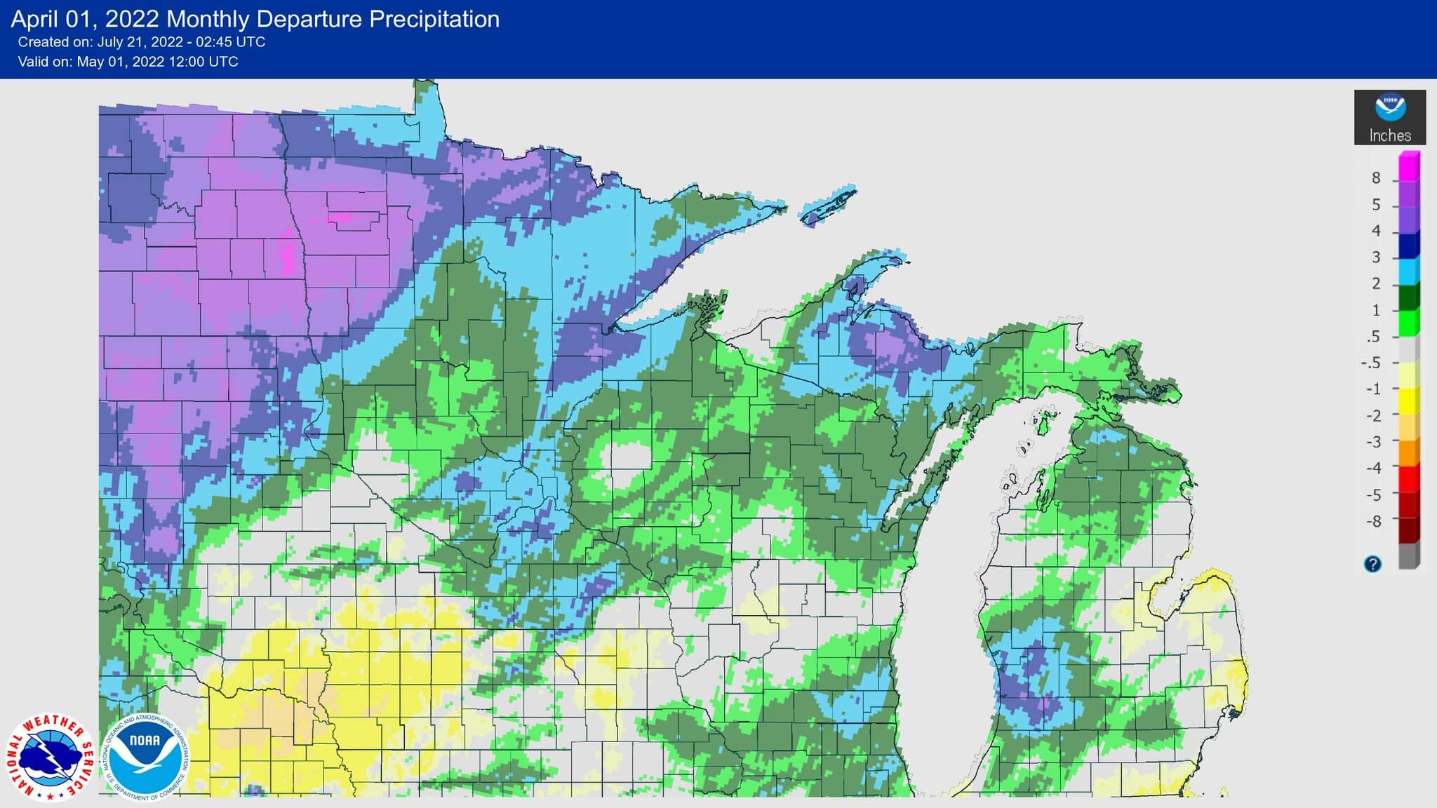
This Map Focuses on the Upper Midwest Precipitation Analysis for April
April showers for the upper Midwest is a time when woodcock are nesting. Taking time to compare the departure in inches from the average monthly rainfall amount helps the hunter understand the nesting conditions for woodcock. Some areas had decent weather while other areas received too much rain.
Tips to predict Bird Hunting Numbers based on Precipitation
Looking at total precipitation per month is a good starting point. However, we need to determine a baseline to help us understand the impact of the Precipitation Analysis status for April. The end of March and the beginning of April are typically times of weather changes, and the swings can be sudden and drastic.
Ask these questions about the areas you will be hunting
- Was the area in a drought with dry soils, or were they excessively wet last fall?
- How much snowpack did the area have on the ground at the end of winter?
- What was spring runoff like in the area you will be hunting?
- How long did spring runoff take?
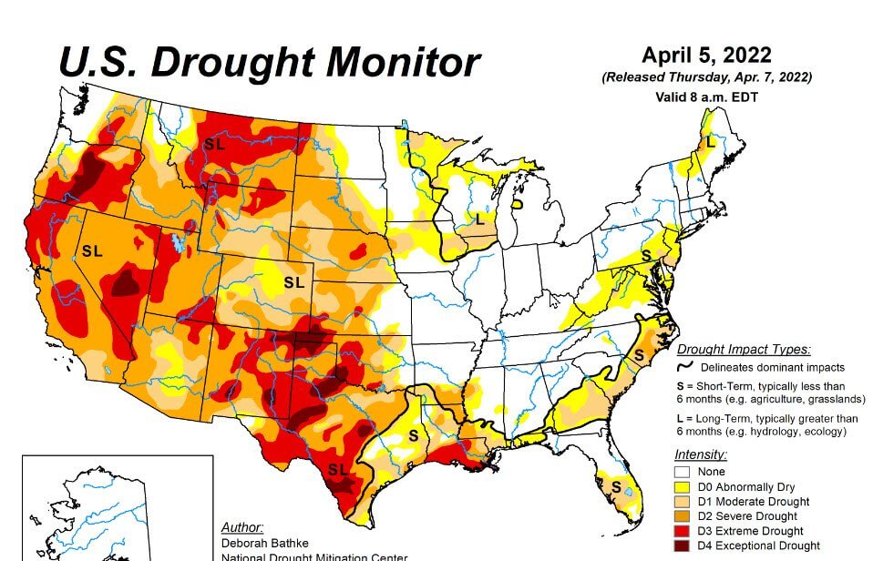
The first map I look at is the US Drought Monitor for the Nation. These maps will help identify areas that are under short-term and long-term droughts.
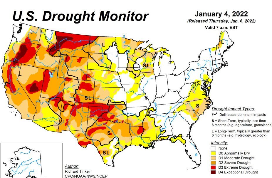
January Drought Map
How to apply these tools to your hunting area
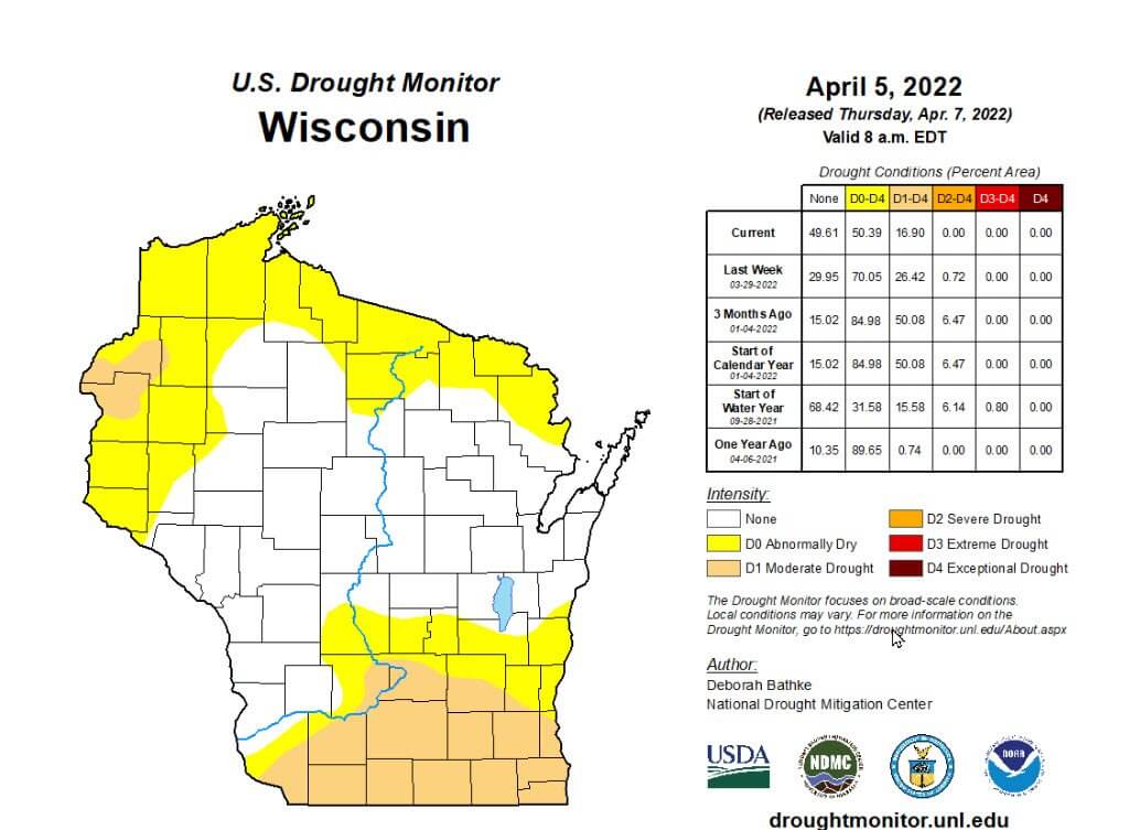
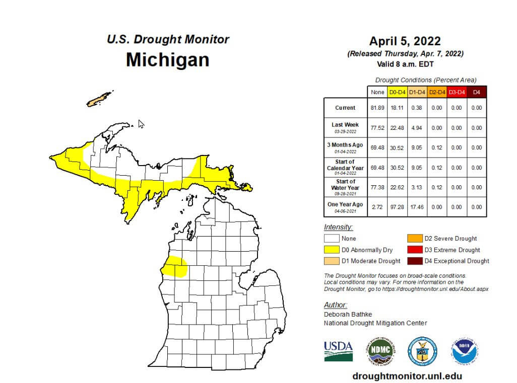
To help you understand how to research your area, let’s look at Michigan, Wisconsin, and Minnesota as examples. Eastern and NE Wisconsin and Central and Southern parts of the UP were between a short and long-term drought “S L. ”
Parts of Minnesota and Northwestern Wisconsin were in a long-term drought going into winter” L.” However, when you look at the April 5th map, it has moved toward a long-term drought status.
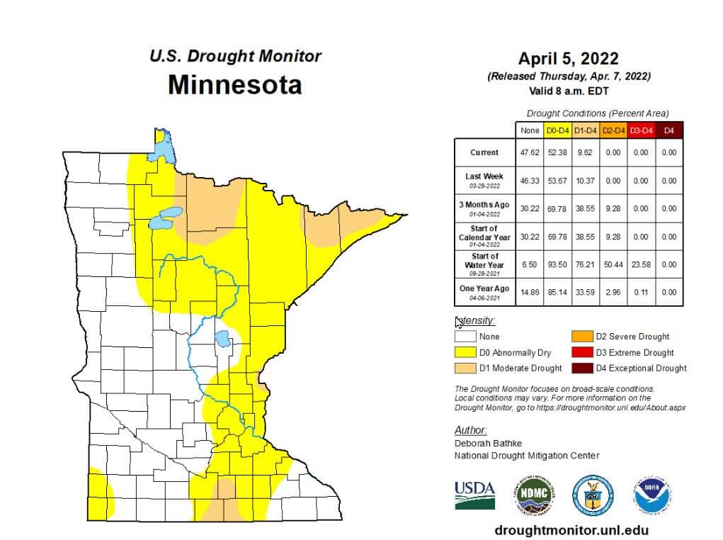
Minnesota April Drought Map
The additional information you can take away from these maps is that most of Northern Wisconsin, Minnesota, and parts of the UP’s soil were not saturated with excess moisture. These drought areas absorbed any snowpack. So those areas will change quickly and will improve.
However, late winter snowstorms and heavy rains can quickly wipe out mild drought areas. So next you need to focus on the timing of the rains in April and transition into May historical weather. Researching more maps and information help give you a better understanding of the spring and summer weather patterns.
Drought & Bird Hunting in Western States
The national news is talking about hot temperatures and droughts in the West daily. Are you thinking about western bird hunting and wondering how bad the drought might be in areas you want to hunt? This short video will help you analyze how the drought is changing across the country. This is just one of the tools I use to help me make decisions on hunting areas new or old.
Remember, weather is key for the breeding season, the hatch, and the food for the young. Timing is critical and poor conditions can change the density of birds in any given area. Many times, hunters think of flooding areas to avoid hunting but drought in many areas has the same negative effect.
If your favorite hunting spot has been negatively effected by weather, check out our maps to find new public hunting areas.