Pinpoint food sources with Crop lands mapped for bird hunting
Identifying Pheasant, Quail & Sharp-tailed Grouse food sources is essential for upland game hot spots
Food Sources & Rotation
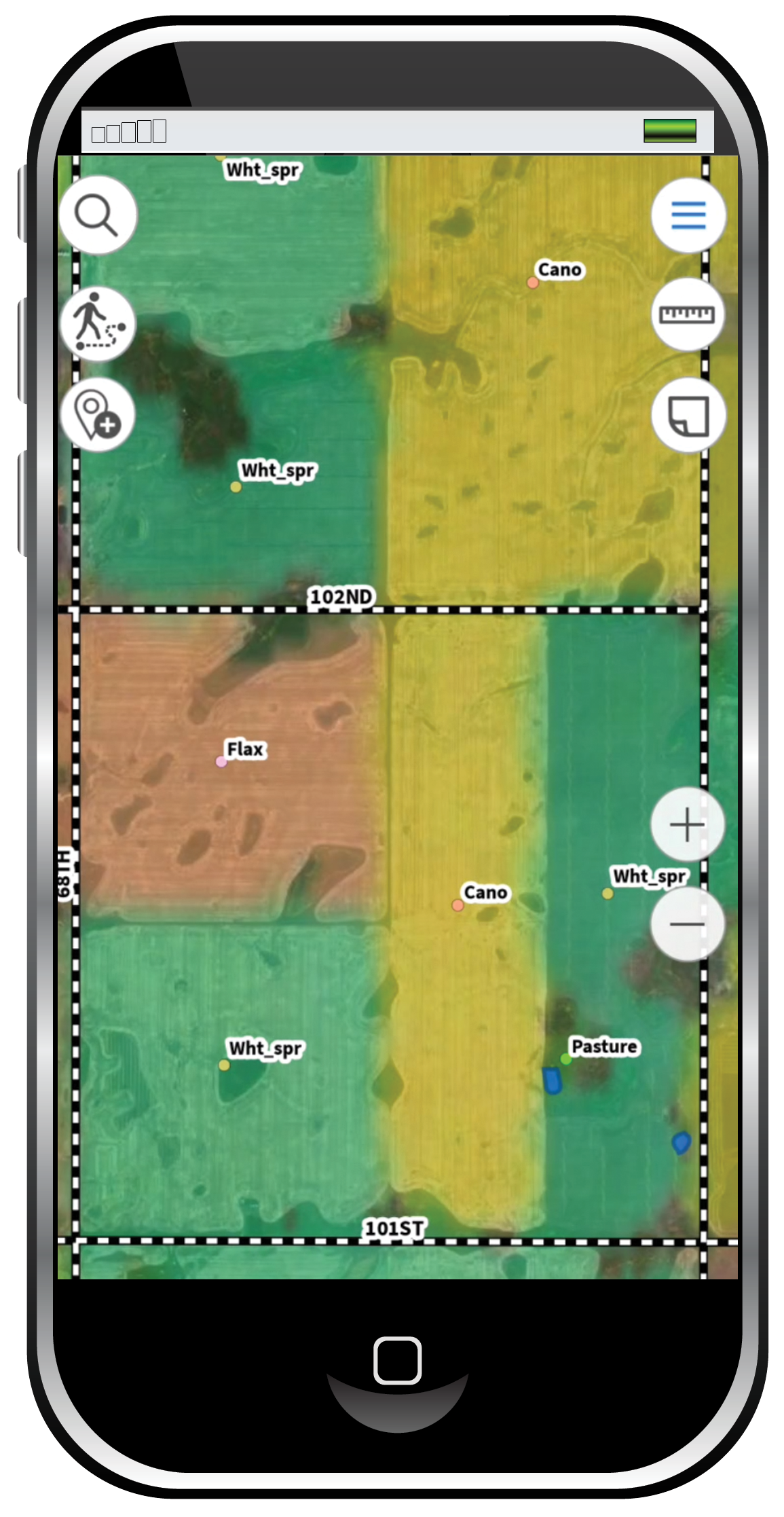
We do the preseason research and layer our maps according to what the farmers say they plan to plant and which fields will lay fallow. Plus, we have crop rotation history from 2022-2016. We track twenty food sources like corn, soybeans, sunflowers, sorghum, etc. Upland birds flock to different food sources based on weather and time of year. You can use our maps to extrapolate where the birds will find the most food if you know which crops are growing where. In a normal year, as the season progresses, soybeans will be harvested but corn will still be on the fields. And our maps show what borders the crops. That’s important because a corn field next to a swale of cattails will entice more birds.
Grasslands
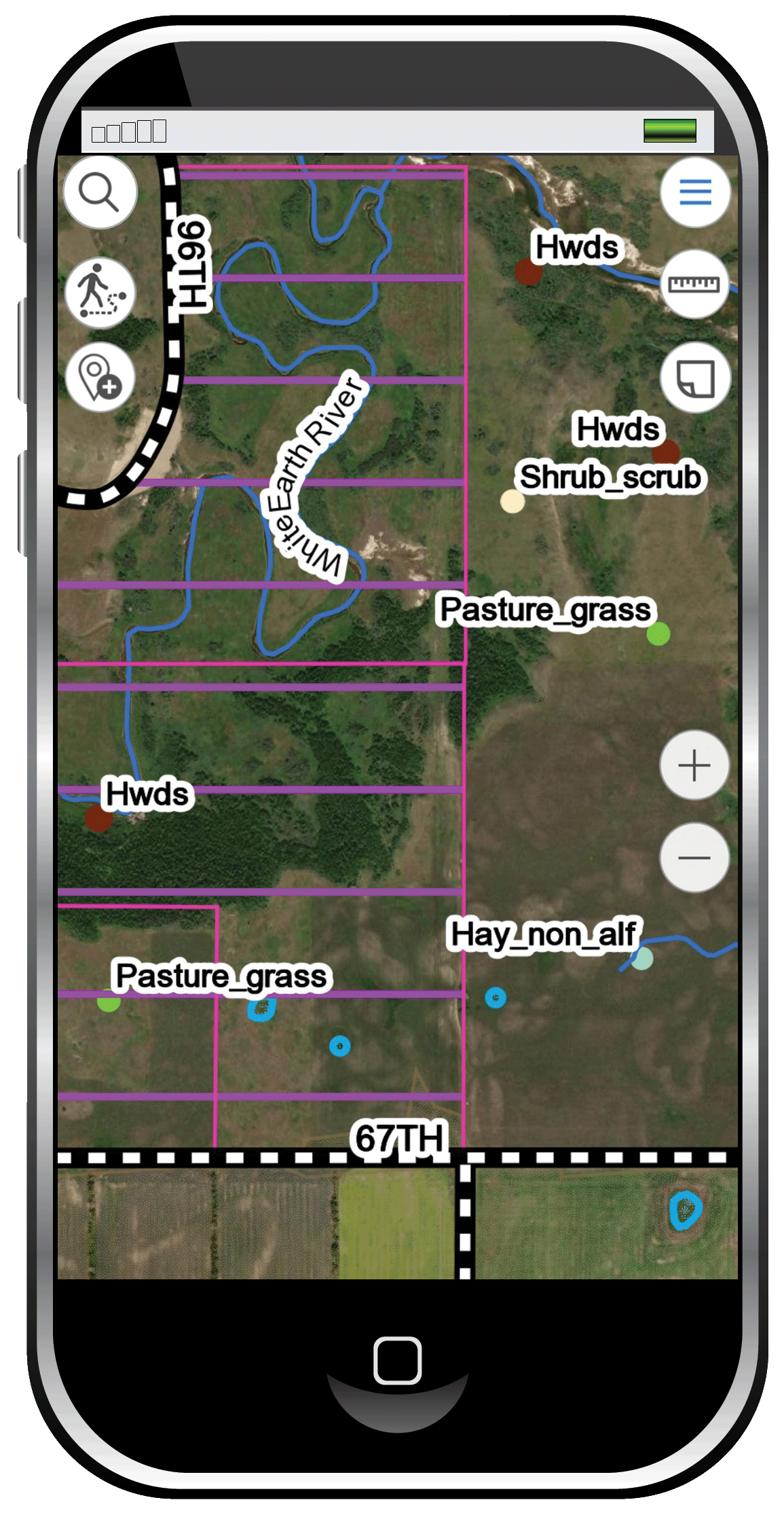
Upland game thrives in various types of grasses throughout the year. Bunch grasses provide cover for hens sitting on eggs, young chicks learning to forage and adult birds. Birds feed on clovers, grains, and various plants found in pastures or CRP lands. Consult our layers to decide which grasslands will be most productive. You’ll be able to follow the food, just like the birds.
Shrub Cover
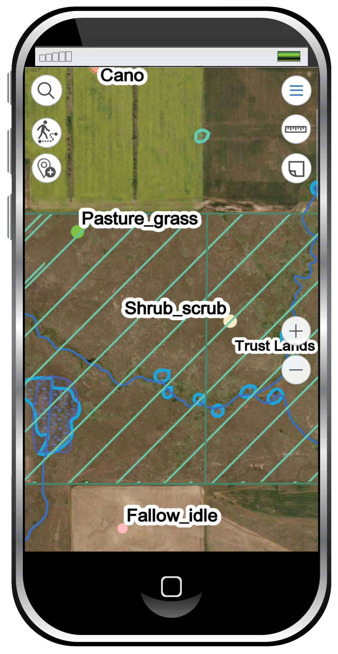
Shrubs block the wind, provide cover against rain and snow and camouflage to hide from aerial predators. Some species, like sage grouse, are comfortable in shrubs all year because sage brush fills all their needs. Other species will sleep or wait out inclement weather in shrubs but must feed elsewhere. Know your shrubs and what they offer the birds. Use our maps to find the shrub cover when that’s where the birds will be.
Self-guided Quail & Pheasant Hunting on Public Hunting Land
Now that you have the best map layering system, it’s time to create more successful hunts. Use your food sources, grasslands and shrub layers to put it all together. Predict where the birds will feed and the likely escape routes they’ll travel between food and shelter.
We designed our cropland layer because pheasants, sharp-tails and quail live near a food source. Knowing which crops are growing adjacent to public hunting lands will increase your odds. Find the food, find the birds. The grassland and shrub layers show where birds will seek likely shelter. Pheasants will head to switch grasses or cattails while Ruffed Grouse move into conifers. The birds are still out there on inclement days, you just look for them in different areas.
It used to take years to learn how to effectively hunt an area. Walk the land, find the edges and likely feeding spots. Which direction will the birds go when jumped on a windy day? Where will you find game when it’s raining?
Our offline, available anytime map layers provide more information than you could acquire in a lifetime of scouting an area. You’ll know where the birds will find food, shelter and security, even where you should park your truck. This is the most important advance in upland game hunting since the pointing retriever. Not only can you use all the layers in conjunction to get a complete picture of the birds’ likely behavior, you can save your hunts to build your own database. Keep track of where you hunted, note the weather and what you found. Hunt-N-Scout helps you do that, and more, so you can have the most successful self-guided hunt possible.
Scout-N-Hunt sources the most up to date crop data for our map layers. The most current imagery is used and updated throughout the season. The tremendous amount of cropland acreage to inventory is a time-consuming process. Farmers sometimes need to shift their plantings due to drought or extreme rains. We do our best to keep the information current but to date, there is no way to guarantee that the crop data layer will be completely accurate. As new technologies come available, we will utilize them so you have the most accurate maps available.
“Scout-N-Hunt, Don’t leave home without it!!”
I wanted to send a note to congratulate you for making such a valuable tool for the DIY-Public land hunter. I’ve used it for three years now in four states. One of the states is my home state, the other three were states I had never hunted before. I didn’t know anyone that had hunted in those three states and I had no local contacts to lean on.
By combining the public land, satellite & road views, and most importantly the crop data, you’ve come up with a truly comprehensive pre-trip scouting tool that doubles as a GPS in the field to keep me within property boundary’s. To be able to see ahead of time where crop fields meet CRP and pastures is invaluable.
With a little time, a dose of common sense, a pinch of experience, and Scout-N-Hunt maps in hand my success has rivaled anyone’s I’ve come across. To illustrate…On my last hunting trip a very kind and generous gentleman had recommended four pieces of land for me to try the next morning. He said he ‘knew’ there were birds there. I had already picked five properties using Scout-N-Hunt. When I got back to the motel room I found that all four of the recommended properties were on my list of five.
-Gary Gunterman